
Stormwater studies, by invitation
Explore a stormwater question on your own site.
Real survey data and real physics. Water depths accurate to within 1 cm (0.4 in) on this demonstration.
Recorded in BaseState from the live simulation, driven by an AI assistant.
Drone survey by 2cofly
What you deliver
Bring one survey and one question. Leave with an answer your client can act on.
Your survey
The orthomosaic and surface model from a drone flight you already have.
Your answer
Where water pools, how deep it gets and how much leaves the site.
Your report
Findings, maps and the model's assumptions, reviewed and signed.
Make it rain (literally).
Replay a real storm or plan for the next one. Ask the AI where water stands, then check the answer on the map.
Drone survey by 2cofly
Real and design storms
Replay a storm from the weather record, or run the 10-year and 100-year storm.
Flooding as it happens
Click anywhere to read depth, flow and the ground that drains to it.
Drains, sized
Place an inlet, a pipe and an outfall, and check flow against capacity before anyone digs.
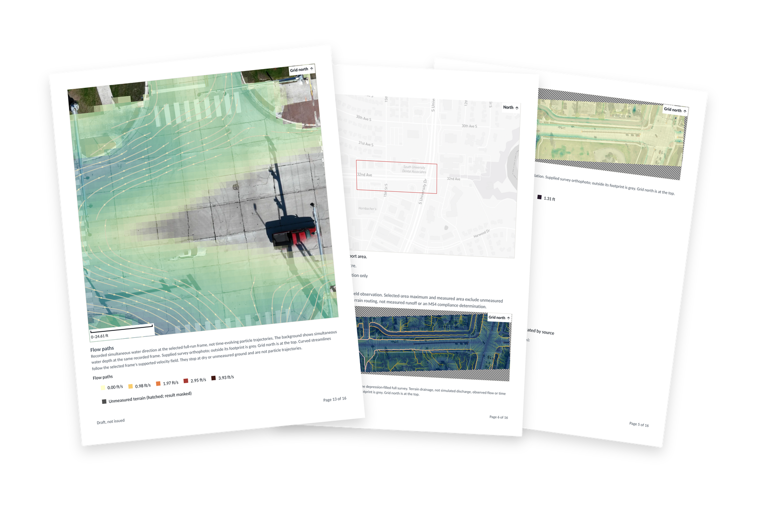
The report your client receives.
Site map, flow paths and water depth for the 32nd Avenue survey, each with its source. Your team signs before it is sent.
Imagery: Northern Drone
Talk to the founders.
Tell us how your team works and what gets in the way. We’ll look at the process together and see where BaseState can help.
45-minute video call with Paul or Hanyi.